
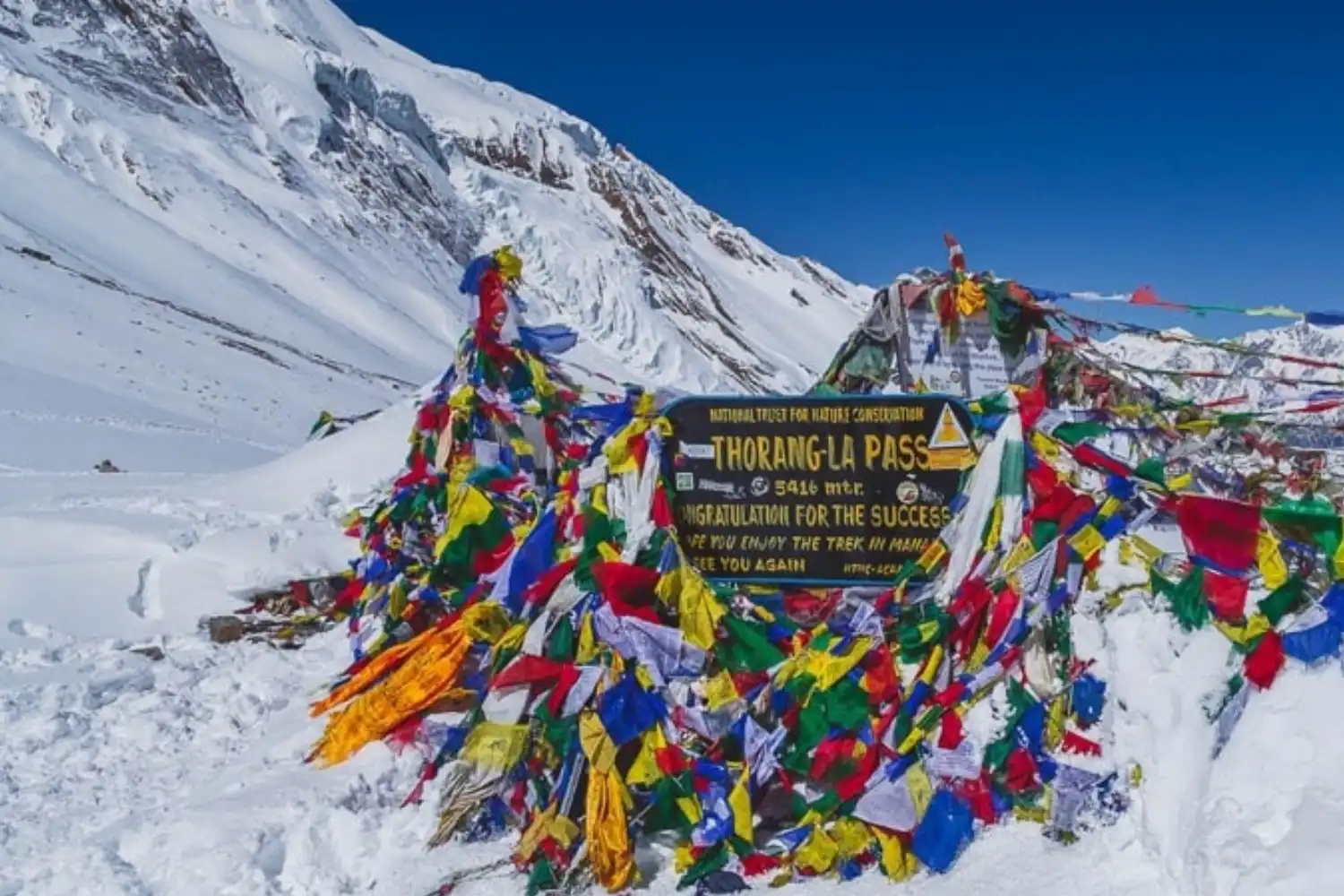
Every trekker who sets out on the Annapurna Circuit is, in some sense, walking toward a single day: the crossing of Thorong La Pass. At 5,416 metres, it's the highest point on the entire route and the moment that defines the trek — a test of preparation, patience, and altitude endurance that rewards trekkers with one of the most dramatic transitions in the Himalayas.
This guide covers everything you need to know about Thorong La Pass — where it is, how high it really is, how to cross it safely, and what to expect on the biggest day of the Annapurna Circuit Trek.
Thorong La sits in the Damodar Himal range, just north of the main Annapurna massif, within the Annapurna Conservation Area. It connects the arid Manang Valley to the east with Muktinath and the Mustang region to the west, forming the link between the Marsyangdi and Kali Gandaki river systems.
The pass lies in the Himalayan rain shadow, which is part of why the landscape changes so dramatically as you cross it — from green, forested valleys on the approach to a stark, high-altitude desert on the descent toward Mustang.
Thorong La Pass stands at 5,416 metres (17,769 feet) above sea level, making it the highest point on the Annapurna Circuit Trek and one of the highest trekking passes in the world. For comparison, it's actually slightly higher than Everest Base Camp, which sits at around 5,364 metres.
At this altitude, oxygen levels drop to roughly half of what they are at sea level, which is why the crossing is treated as the most serious single day of the entire trek.
Thorong La cannot be crossed directly from Manang in a single day — the distance and elevation gain are too great. Instead, trekkers break the approach into stages:
Almost all trekkers cross from east to west — Manang to Muktinath — since this direction spreads the altitude gain over several days and ends with a gradual descent. Crossing from Muktinath to Manang involves a much steeper, more abrupt ascent and is considered significantly harder and riskier for altitude sickness.
Crossing day starts early — most trekkers leave Thorong Phedi or High Camp between 3:00 and 5:00 AM, well before sunrise. The early start isn't just tradition: it's a strategy to reach the pass before strong winds typically pick up by mid-to-late morning.
From High Camp or Phedi, the trail climbs steadily through a high alpine, moraine-covered landscape before reaching the top of the pass, marked by Buddhist chorten (stupas) and strings of prayer flags. Most trekkers take 7 to 10 hours total to complete the crossing, factoring in both the ascent and the long descent to Muktinath.
The descent is often mentioned as being just as demanding as the climb — tired legs and a long, steep drop in elevation make trekking poles and careful footing essential on the way down.
Thorong La's difficulty comes from a combination of factors rather than any single obstacle:
Importantly, Thorong La is not a technical climb — no ropes, crampons, or mountaineering experience are required. The challenge is almost entirely about altitude, endurance, and pacing rather than climbing skill.
Because weather and snow conditions can change from year to year, it's essential to check current conditions with a local guide or trekking agency before your crossing date, especially outside the main autumn and spring seasons.
Given the seriousness of the altitude involved, proper acclimatization is the single most important factor in a safe crossing:
Reaching the summit of Thorong La is one of the most memorable moments on the Annapurna Circuit, marked by prayer flags fluttering against a backdrop of high Himalayan peaks. After the effort of the climb, most trekkers only pause briefly at the top before beginning the long descent, since weather and wind conditions can shift quickly.
The descent leads down into the dramatically different, high-desert landscape of the Mustang region, arriving eventually at Muktinath, a sacred site for both Hindu and Buddhist pilgrims. The contrast between the alpine world above Manang and the arid valley below Thorong La is part of what makes this crossing feel like two entirely different treks joined by a single mountain pass.
How high is Thorong La Pass? Thorong La Pass sits at 5,416 metres (17,769 feet) above sea level, making it the highest point on the Annapurna Circuit Trek.
How long does it take to cross Thorong La Pass? Most trekkers take between 7 and 10 hours to complete the full crossing, including the ascent from Thorong Phedi or High Camp and the descent to Muktinath.
Which direction is safer to cross Thorong La Pass? Crossing from east to west — Manang to Muktinath — is the standard and safer direction, since it spreads altitude gain over several days. Crossing from Muktinath to Manang involves a steeper, more abrupt ascent.
Do I need mountaineering experience to cross Thorong La Pass? No. Thorong La is not a technical climb and requires no ropes or climbing gear. The main challenges are altitude, distance, and endurance rather than technical skill.
What is the best time of year to cross Thorong La Pass? Autumn (September–November) and spring (March–May) are the most popular and generally most stable seasons. Winter crossings can be difficult or impassable due to snow, and monsoon season is typically avoided.
Is altitude sickness a serious risk at Thorong La Pass? Yes. At 5,416 metres, oxygen levels are roughly half of sea-level values, so proper acclimatization — including a rest day in Manang — is essential to reduce the risk of acute mountain sickness.
Where do trekkers stay before crossing Thorong La Pass? Most trekkers spend the night before the crossing at either Thorong Phedi (4,540m) or Thorong High Camp (4,880m), both located below the pass on the Manang side.
Is a guide required to cross Thorong La Pass? While regulations can vary, most trekkers cross with a licensed guide, both for safety and because guides are experienced at spotting early signs of altitude sickness and monitoring changing weather conditions.
Thorong La Pass isn't just the highest point of the Annapurna Circuit — it's the day that brings everything the trek has built toward into sharp focus. Weeks of gradual acclimatization, careful pacing, and steady walking all culminate in a single demanding crossing between two dramatically different worlds. With the right preparation, Thorong La Pass becomes one of the most rewarding achievements in Himalayan trekking. If you're planning your Annapurna Circuit itinerary, check out our full trek guide or get in touch with our team to help plan your crossing.
